– COMMUNICATION LINKS –
CHECK LOCAL LAWS & REGULATIONS AS SOME REGIONS MAY NOT ALLOW THE USE OR REQUIRE A HAM RADIO LICENSE AND FAA LICENSE TO OPERATE THE VARIOUS RADIO LINKS OFFERED ALONG WITH OPERATING DESERT ROTOR GCS
Desert Rotor Ground Control Stations Are Compatible With Other RF Transmitters Radios. Ask Us About Other Options!

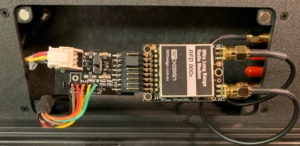
RFD 900x/868x Radio Modem-
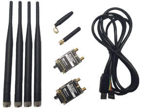
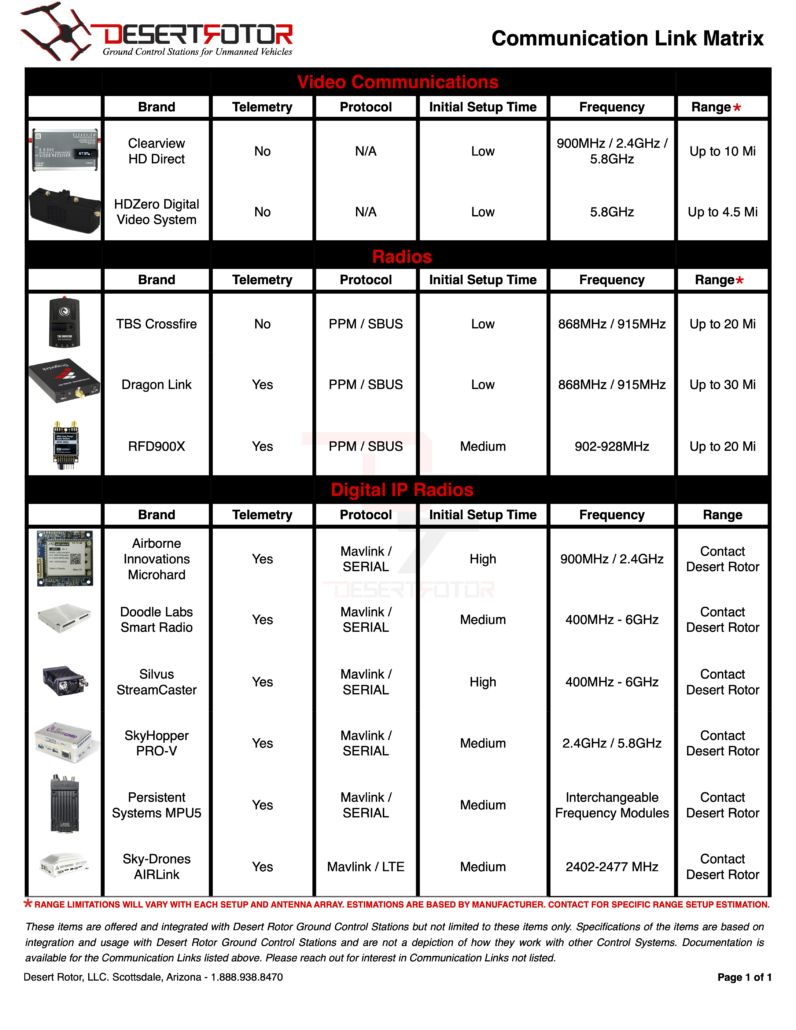
The RFD900x/868x are long range data telemetry modem operating in the 902-928MHz and the 868-869MHz ISM band. Operating at 1W transmission power, it is capable of holding a data link at over 40km. Compatible with APM 2.x and Pixhawk.
Custom designed RFD Radio Docks allow for plug-and-play connection with Desert Rotor Ground Control Stations.
- 2x RFD Radio Modems
- 2x Monopole 2dBi Antennae
- 2x Dipole 3dBi Antennae
- 1x FTDI Cable
- 1x Pixhawk to RFD Telemetry Cable


900MHz/2.4GHz Picoradio™ w/embedded Microhard™-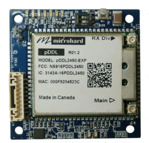
Picoradio is our advanced single link system for UAS/Multicopters. With it you can perform 3 functions in one- HD video capable data rates, autopilot command & control, and manual control with our addon SBUS passthrough module. Picoradio is a high power long range broadband COFDM link. The board has a ton of onboard features all crammed into a tiny 18 gram package.
900MHz/Triband Picoradio™ MIMO Nx-
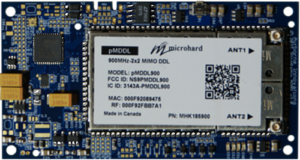 We are proud to present Picoradio MIMO NX, a next generation smart broadband IP radio which takes the Picoradio platform to a new level. Based on the Microhard pMDDL, this is available with either a 2×2 MIMO 900 MHz radio or a tri-band 1.2 / 1.6 / 2.0 GHz 2×2 MIMO L-band radio (and soon with a dual switchable 5.0-5.9 GHz/ 2.4 GHz MIMO radio). Featuring an onboard user-accessible processor capable of ethernet / serial / CAN bus communications, switchable USB slave, onboard temperature sensing, fan control, additional ethernet interface, and onboard switchable manual control / SBUS features.
900MHz or 2.4GHz Microhard™ Digital IP Modem-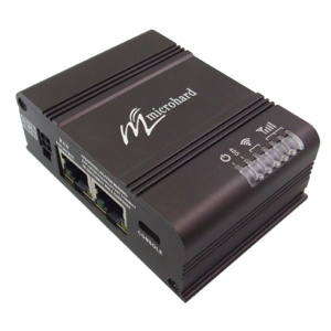
The Pico Digital Data Link (pDDL) provides the bandwidth and range needed for complex data applications. The pDDL provides fast and secure, simultaneous Ethernet and Serial based data communication. Robust digital modulation technology provides for an innovative solution for secure data transfer and extended range requirements.
4G/LTE Microhard™ Cellular Radio-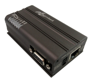
The Bullet-LTE provides a compact, robust, feature packed industrial strength wireless M2M solution using incredibly fast 4G/HSPA+/LTE network infrastructure. Connected internally to the 12PCX HOTAS and you’ll have high-speed cellular remote access.
Airborne Innovations Picocamera-
Picocamera is an integrated camera and IP video encoder solution. It is currently available with a 720P global shutter camera module, and mates well with Picoradio to form a long range integrated video link solution.
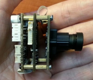 · 720p60 and 720p30 modes
· 1080p rolling shutter sensor option (special order)
· Power: 12V input
· Output: Ethernet IP video stream, RTSP
· Bitrate: 1-5 Mbps @ 720P30
· Latency: End to end latency as low as approximately 100 msec (720p60 mode).
[Note: Designed for straightforward integration with Picoradio]
Airborne Innovations Tracking Antenna-![]()
Our tracking antennas are typically supplied with integrated Picoradio datalinks, choose from 2.4 GHz MIMO, dual 900 MHz / MIMO, 1.8 GHz, 2.3 GHz, or our new Picoradio MIMO NX 900 / MIMO NX-Tri band 1.2 / 1.6 / 2.0 Ghz MIMO radios.

StreamCaster 4200EP-
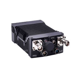 SC4200EP is a 2×2 MIMO radio, delivering best-in-class performance and efficiency in a miniature package. It is ideal for use in portable and embedded applications where size, weight, power or cost are key.
SC4200EP FEATURES
- Up to 10 Watts of output power (20W effective performance, thanks to TX Eigen Beamforming)
- Available in 3 form factors to suit a variety of applications:
- Rugged “brick” (externally powered)
- Rugged handheld (w/ twist-lock battery connector)
- Non-rugged OEM (for embedding in custom products and sub-systems)
StreamCaster 4400E-
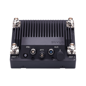 SC4400E delivers the power of 4×4 MIMO in a ruggedized package. SC4400E is ideal for use in fixed infrastructure, vehicular, long range, and airborne applications where maximum performance is desired.
SC4400E FEATURES
- Up to 20 Watts of output power (80W effective performance, thanks to TX Eigen beamforming)
- Rugged outdoor rated housing with optional pole mount and surface mount hardware available
- Available in 3 form factors to suit a variety of applications:
- Rugged with straight RF connectors (designed to be mounted horizontally)
- Rugged with right angle RF connectors (designed to be mounted vertically)
- Non-rugged OEM (for embedding in custom products and sub-systems

Embedded Smart Radio-
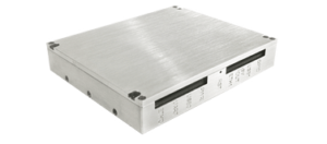
The Smart Radio’s Embedded form factor is designed for ease of integration in space and weight-constrained applications like small UAS. The radio’s CNC fabricated casing is made from lightweight aluminum and acts as a heat-sink as well as RF shield. For extreme environments, an optional heatsink is available.
The MPU5 is the result of years of meticulous design and engineering – from the interchangeable frequency module to the multi-functional side connectors – to ensure optimal functionality and performance for you and your team. Designed to withstand extreme conditions in the harshest environments, the MPU5 is rated to the highest standards for temperature, water immersion, shock, salt fog, and security.
- Input Voltage – 8 to 28 VDC
- RF Connectors – (3) RP-TNC Female
- GPS Connector – (1) SMA Female
- Video In – (1) HD-BNC & SD and HD sources
- DATA – 10/100 Mbps Ethernet, Serial RS-232, USB On-the-Go
- Crypto Modes – CTR-AES-256 Encryption & SHA-256 HMAC
Wave Relay is a registered trademark of Persistent Systems, LLC. Use of this trademark by Desert Rotor is for identification purposes only and does not imply an endorsement from the trademark owner.

SmartAP AIRLink-
AIRLink stands for Artificial Intelligence & Remote Link. The unit includes cutting-edge drone autopilot, AI mission computer and LTE connectivity unit. Start your enterprise drone operations with AIRLink and reduce the time to market from years to months down to a few weeks.
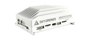
- FPV and Payload camera inputs, HD FPV camera included
- 3x-redundant vibration-dampened temp-stabilized IMU
- Internet connectivity: Ethernet, Wifi, LTE 4G/5G
- Sky-Drones Cloud connectivity and remote control
- UTM integrated and BVLOS ready
- Deploy your own apps
More info: https://sky-drones.com/airlink

Triad RF Systems THPR1006-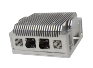
Triad’s THPR series break performance barriers for MIMO radios and enable first-run link success. They eliminate the need to integrate stand-alone components for long range wireless links. Triad combines our high power RF sub-systems with a PicoRadio pMDDL2450 OEM core radio in a low SwAP package. The Triad High Power Radio (THPR) contains 20W bi-directional amplifier (BDA), the radio, RF filtering, and innovative SoC-based monitoring and controls, with real-time power measurements and link diagnostics. When paired with Airborne Innovations Antenna Tracker, get up to 30 miles / 48km in range.

SkyHopper PRO V –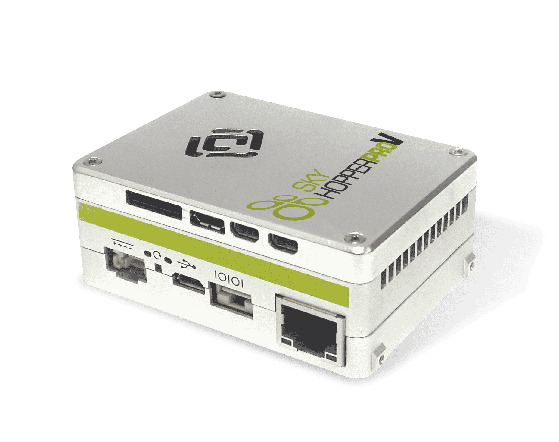
SkyHopper PRO V offers a bi-directional Cybersecure Software Defined Radio (SDR) data link with video processing capabilities specifically designed for commercial and industrial drones. The Skyhopper PRO v employs leading wireless technologies including dual video inputs and outputs, dual built-in video encoders/decoders, three camera interfaces, and local recording ability.
SkyHopper PRO V provides long-range (LOS) capabilities and a robust radio signal in non-line-of-sight (N-LOS) environments that support multiple transmission modes. SkyHopper PRO V supports point-to-point communication with numerous viewers and offers built-in flexibility for the best optimization and customization.

Dragon Link-
The Dragon Link Advanced 915 MHZ WiFi is Constructed using the best performing, highest quality components, latest and most advanced technology available. Designed to work with 1.3 GHZ, 2.4 GHZ, and 5.8 GHZ video systems. The built in long range Radio Modem will give you every option imaginable to display telemetry on computers, tablets, phones, and other ground station devices. The Dragon Link system will connect connect to Windows, Apple, and Android devices via WiFi and Bluetooth.
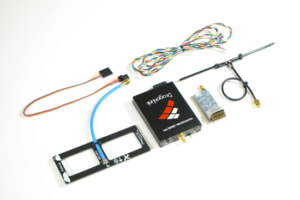
- Transmitter Module Voltage: 5 – 18 Volts (2-4 cell LiPo)
- Receiver Voltage: 5 – 9 Volts (BEC or 2 cell LiPo)
- Transmitter Power Output: 1000 mW
- Frequency: 915 MHZ – Frequency Hopping in ARS Band.
- Typical Range: 50 KM Using Supplied Antennas

TBS Crossfire™ 868MHz/915MHz-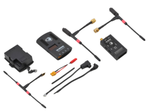
The TBS CROSSFIRE is a long range R/C link based on the newest RF technology, capable of self-healing two-way communications and range beyond comprehension. With a sensitivity of -130dB, full RF-side diversity, tiny receivers for FPV quads, the TBS CROSSFIRE contains the most modern technology to provide a superior long range control link

Clearview™ HD Direct Video System-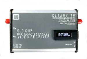
Iftron’s ClearView HD Direct Video System consists of our new 2 watt, dynamically variable power (VPS), HD-VTX video transmitter and our new ClearView VPS receiver. Together they provide superb low-latency HD downscaling directly from an HD equipped camera while automatically varying the HD-VTX RF power level as needed as range and obstacles demand. This avoids interfering with adjacent receivers when the VTX transmitter is at close range – all in a very compact, powerful and lightweight system.

HDZero Digital Video System-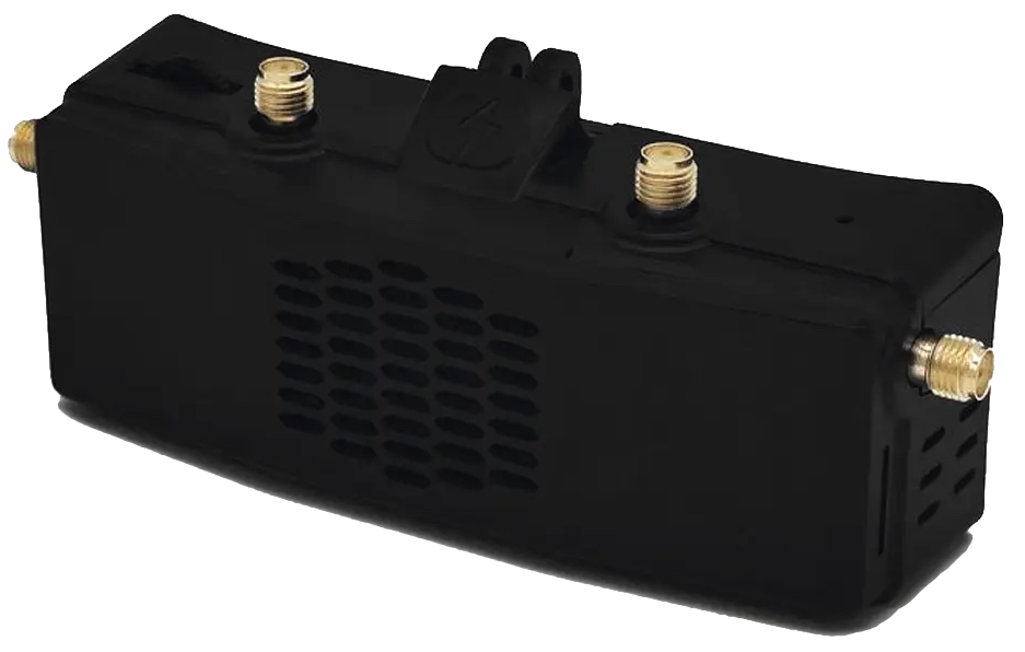
The HDZero is a digital HD video system which streams with near zero latency. The system streams 720p 60fps video on 5.8GHz and is capable of delivering up to 1000mw. The VTX integrates a surge protection circuit, a large capacitor (450+uF) parallel with battery leads which allows a smooth power supply delivery to your aircraft.
- Frequency: 5.725-5.850GHz
- Resolution Default: 1280*720@60fps
- RF power: 25mw/200mw/500mw/1000mw
- Power input: 7V-26V(2S-6S)

Autonodyne Autonomy Software-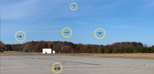
In aviation, Smart Automation is defined as automating certain elements of flight preparations and flight control. Specifically, it targets context-sensitive tasks to reduce the workload peaks and overall workload of humans. We view this as a means to accomplish Simplified Vehicle Operations. Some examples, to name a few, include:
- Automating checklists.
- Extensive monitoring and data logging of a flight system’s state.
- Using connectivity to create a “distributed cockpit.”
- Automatic route planning based on vehicle state or contingency.
- Vastly simplifying “cockpit” displays to be less aviation-specific and more in-line with visualizations people are used to.
- Enabling reduced crew operations.
Autonodyne’s software has been specifically designed to support multi-ship collaborative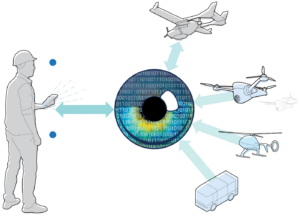 autonomous operations. This approach permits dissimilar UVs to communicate with each other to perform swarm-like behaviors. While multiple architectures are possible to enable these capabilities, to date, we’ve implemented an IP-network-based approach so that every mission computer and control station is an entity in the network.

SPH Engineering UgCS DJI-
UgCS is a Ground Control Mission Planning software which supports Automated drone mission planning, built-in Photogrammetry and Geotagging tools, Digital Elevation Model (DEM) and KML file import enables map customization, and battery change option for long routes make UgCS an effective solution for large area surveying.
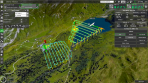
Using UgCS with Desert Rotor Ground Control Stations also gives users the capability to manually control compatible DJI drones via GCS controls.
- Terrain following
- Route import from KML or CSV files
- Photogrammetry tool
- Vertical scan tool
- Area Scan tool for non-camera sensors
- Corridor mapping, SAR patterns
- Import custom map and terrain elevation data
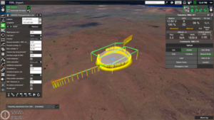
- Live geotagged video stream
- Work offline
Supports most popular UAV platforms including DJI M300, M600, M2X0, Inspire, Phantom series, Mavic series, and MAVLink-compatible drones (Pixhawk with ArduPilot/PX4)
For more information visit: https://www.ugcs.com/
– Check out an instructional video on the 12PCX ground station and Airborne Innovation’s revolutionary products –
Check Us Out on Facebook!
Desert Rotor
Streamline your operations by utilizing a professional Ground Control Station specifically designed for your unmanned systems!


